 Diese Seite gibt es auch auf
Deutsch
Diese Seite gibt es auch auf
DeutschTrekbuddy is an app for mobile phones (Android, J2ME), which can display offline road maps and hiking maps on any Java-enabled mobile phone.
For mobile phones with GPS receiver, Trekbuddy displays the current position on the map. This page contains some useful links to enable an effective start with Trekbuddy and offers ready-made Trekbuddy maps based on Openstreetmap data for download.
Quick Start
In order to use the program, Trekbuddy must be installed on the phone and a map file must be available. Since 2020, the program is no longer supported but it still works and source-code is available on Github.
Installation file with simple world map for Android: To install Trekbuddy with a small Openstreetmaps world map, I created a modified installation file. If the included small world map is sufficient, no additional map has to be downloaded. To install this version, download the Android installation package TrekBuddy_Worldmap.apk and open this APK file on your mobile phone. Installing from unknown sources must be allowed in Android. On most newer phones, it is recommended to open Settings/Desktop and set "Map zoom" to 300% to scale the map for better readability.
Installation File for J2ME: To install the program for ancient JAVA mobile phones, just open this link directly in the mobile phone browser. The downloaded version has some additional adjustments for SonyEricsson mobile phones and in the German O2 GSM network it is possible to display the approximate position of the mobile phone without any GPS receiver. To use this feature, select the option "O2 '" under Settings / location / provider.
World Map
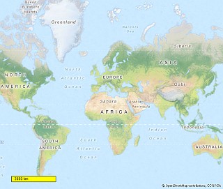 If
you want to install a small world
atlas on your smartphone,
this map is for you. The map covers the whole Earth in the resolution
of a standard atlas for school and home use.
If
you want to install a small world
atlas on your smartphone,
this map is for you. The map covers the whole Earth in the resolution
of a standard atlas for school and home use.
World.zip (ZIP file, download size approx. 103MB)
After unpacking the ZIP file to a suitable directory on your mobile
phone, the atlas is ready to go for display in TrekBuddy. Choose the
file "world.tar" to open the map. The whole earth can be represented
in two coarse resolution levels. Regional maps of USA,
EU and Japan / Korea are also available in a third, finer
resolution level.
Map of Germany
There are there three versions with maps of Germany for use with Trekbuddy available. Please download the file you prefer to your PC, unzip and copy all the unzipped files to the phone (or an external memory card that can be inserted into the phone). To open the map, select the file "deutschland.tar" or "map.tar" in Trekbuddy.
Deutschland.zip (ZIP file, download size approx. 65MB) is ready to go and covers Germany, Switzerland and Austria (D-A-CH) as well as neighbouring countries in the resolution of a typical street map for cars. A rough map is available for all of Central Europe. This map contains two levels ("land" and "region").
DeutschlandExtra.zip(ZIP file, download size approx. 553MB) contains all maps of the atlas above and additional detailed maps of selected regions. This map contains 7 resolution levels. The first three levels are identical to the World Map. The fourth level contains overland roads for the whole of Germany, Switzerland and Austria. The cities Berlin, Leizpig, Dresden and their surroundings are included in the finer resolution levels up to detailed street level. In the detailed level there are, among other things, footpaths, building outlines and restaurants listed. In addition, there are high-resolution maps for Saxon Switzerland and the Spreewald, in which many hiking trails are marked.
Map.zip (ZIP file, download size approx. 944MB) contains all maps of the atlas above and additional road maps of Munich, Hamburg and Prague.
Map of Western Canada
Western Canada from the Pacific coast up to the national parks in the Canadian Rocky Mountains is a charming destination for nature lovers and individuals. I'm offering a prepared Trekbuddy map for Canada / West. The map of Western Canada is particularly tailored to the needs of tourists. This map is created based on OpenStreetMaps.
Canada.zip (ZIP file, download size approx. 80MB)
The map is ready to start. It is covering Western Canada from the Pacific to the Rocky Mountains. The first two stages of coarse resolution "Country" and "Regional" are available for the whole area. The finer resolution levels mainly cover areas of touristic interest, e.g. Canada's national parks, big cities and the Okanagan Valley. The western coastal cities of Vancouver and Victoria (British Columbia's province capital) can be zoomed down to street level.
Detailed maps for all of Germany
Unfortunately, it is not practical to provide a detailed map for Trekbuddy that covers the whole of Germany. Such a map would be enormous because Trekbuddy only processes bitmap based maps. If you are using an Android phone, there is a good alternative: The Android app Oruxmaps (a paid version is available in the Google Playstore). This app can use vector maps offered on the Openandromaps site for all of Germany, and most other countries of the world. The Germany map of Openandromaps is more than 1 GB in size, but contains practically all the details recorded in Openstreetmap.
Germany Railmap
Rail.zip (ZIP file, download size approx. 80MB) is a railway-oriented map. This map displays an overview map of the european train network and detailed maps of the railway lines throughout Germany with their maximum permissible speed. So the next time you are on a train and wonder why the train is travelling so slowly, just look up how fast it should be travelling at its current position. Often it is not the fault of the train driver or the company, but the dilapidated tracks simply do not allow higher speeds).
Most of this webpage is dedicated to Trekbuddy, but this map is also available here for other apps:
RailMap.zip
(ZIP file, download size approx. 220MB) is the railway-oriented map in
a format which can be used by Oruxmaps and other apps which
display MBTiles maps.
Related Sites
MAC - The "Mobile Atlas Creator" allows you to create custom maps for Trekbuddy, Oruxmaps and other apps from various sources on the Internet (OpenStreetMaps, etc.)
Geocaching - Trekbuddy is the ideal tool for geocaching. The English page for this hobby with hundreds of thousands of geocaches in Germany and worldwide can be found on Geocaching.com. An alternative is Opencaching.de, a German site, which also lists a large amount of geocaches.
GPXView - This site visualizes tracklog routes which were recorded by Trekbuddy (and saved in GPX format) using online maps
GPXReport - Generate reports from tracklog route data in GPX format (route length, average speed, etc.)
I look forward to opinions and feedback on this page. My Email can be found on the Imprint page.